Funded by the European Space Agency from March 2020 to March 2021
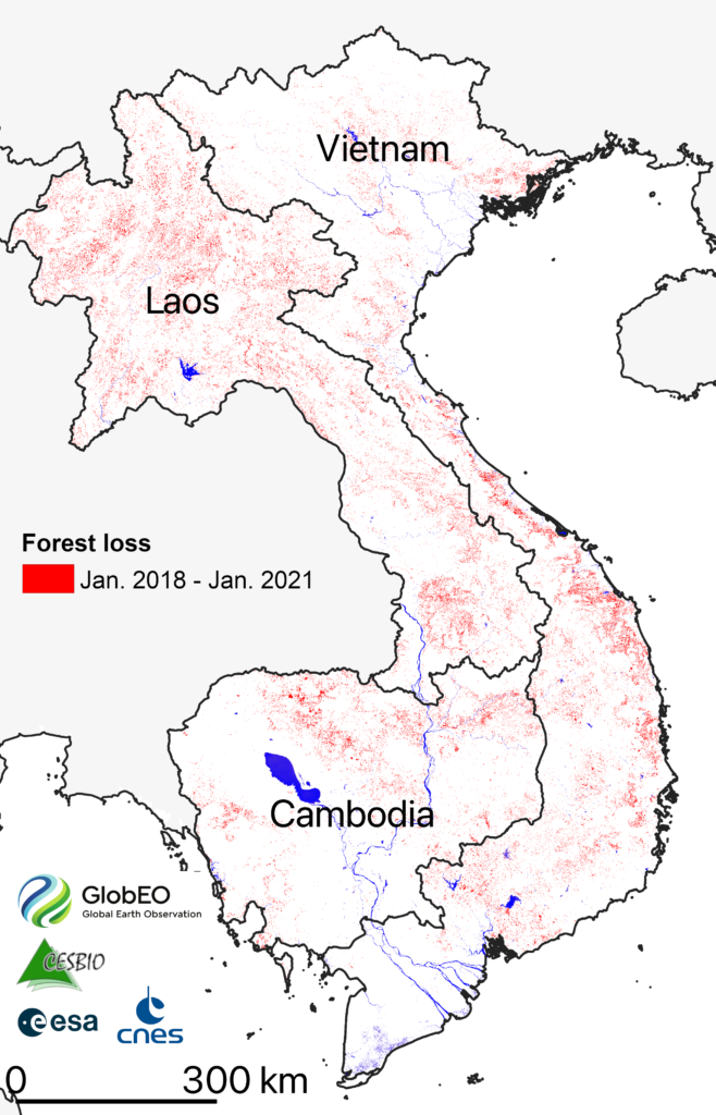
The overall project goal is to provide fully validated forest loss maps every month over Vietnam, Cambodia, and Laos, based on Copernicus Earth observation Sentinel-1 satellite data, to the users of public sectors to support their efforts to control logging and log trade.
Satellite imagery is the primary tool for providing information on newly deforested areas in vast and sometimes inaccessible forests. However, most monitoring approaches rely predominantly on optical remote sensing. Nevertheless, a major limitation for optical-based applications is the presence of haze in the dry season (caused by fire) and, more importantly, of clouds in the wet season. Some countries like Vietnam suffer from pervasive cloud cover throughout a large part of the year.
The dense time series of the Sentinel-1 constellation offer a unique opportunity to systematically monitor forests at a repeat cycle of 6 to 12 days. With such temporal series of C-band data, new methods based on SAR data for forest loss monitoring have been developed. and successfully applied at the local scale. GlobEO and CESBIO adapt and test these methods at the national scale in the SOFT project.